Web-page
Under Construction -always will be - this version Dec.
2017
Apartment
10, Bettina, Saas-Fee, Switzerland
Information for friends &
family
A
one bedroom apartment, comfortably sleeping 4 in 2 separate rooms, in
the skiing and walking resort village of Saas-Fee in the Valais,
southern Switzerland
|
|
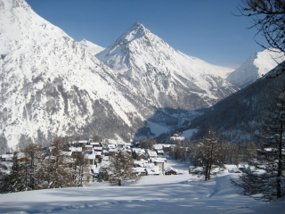
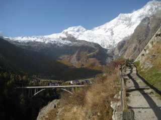
Saas-Fee
One
of the most famous alpine villages, set at 1800m within a ring
of 4000m+ peaks, 9 of which are in plain view from the village.
"Few alpine villages have a more dramatic setting"
- Kev
Reynolds - " Walking in the Valais".
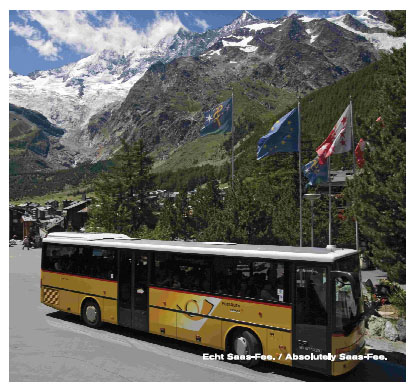
Essentially free of conventional road traffic, almost all
vehicles are electric - conventional vehicles must be left at
car-parks at the edge of the village.
You may have
seen it on the Wham video for 'Last Christmas'.
Video
of Last Xmas
Spoof
video made recently - it's really very good
The main
skiing season is from mid-December to mid-April and the summer season
including summer skiing from early June to mid-October although some
hotels, restaurants, shops and cable-cars may be closed at the
extremes of these dates.
Video of
mountains from Bettina's balcony
Cable-car
timetable
Saas-Fee
Map
(Bettina is House No. 152D in square U4)
|
|
|
|
|
|
World
Travel Guides - Saas-Fee
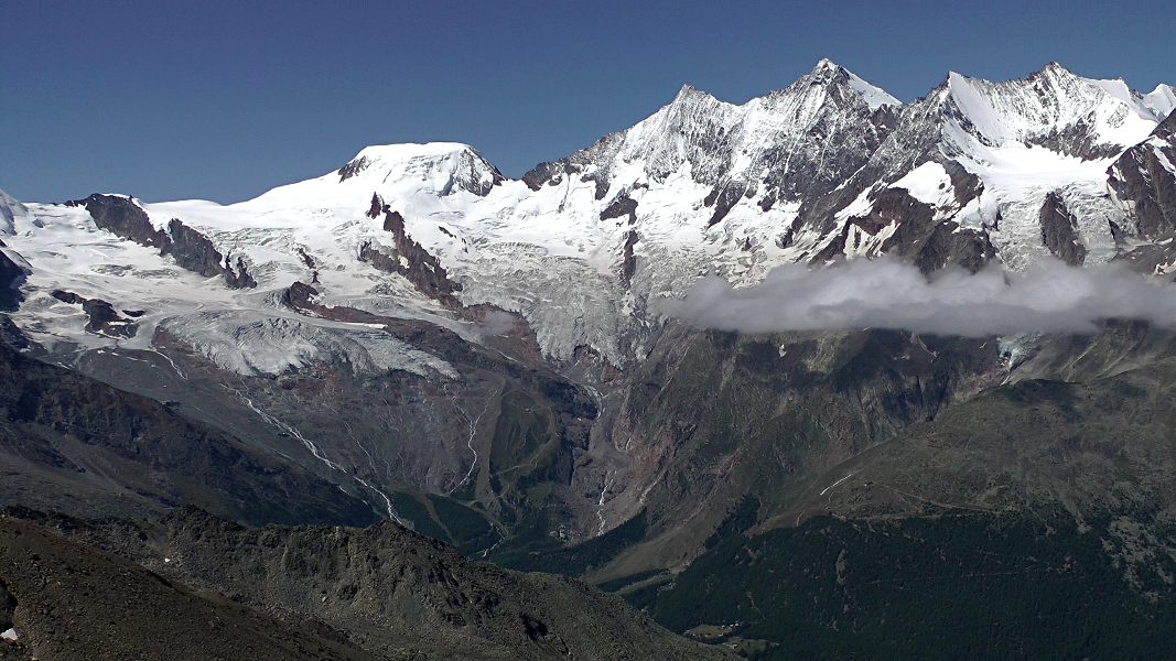
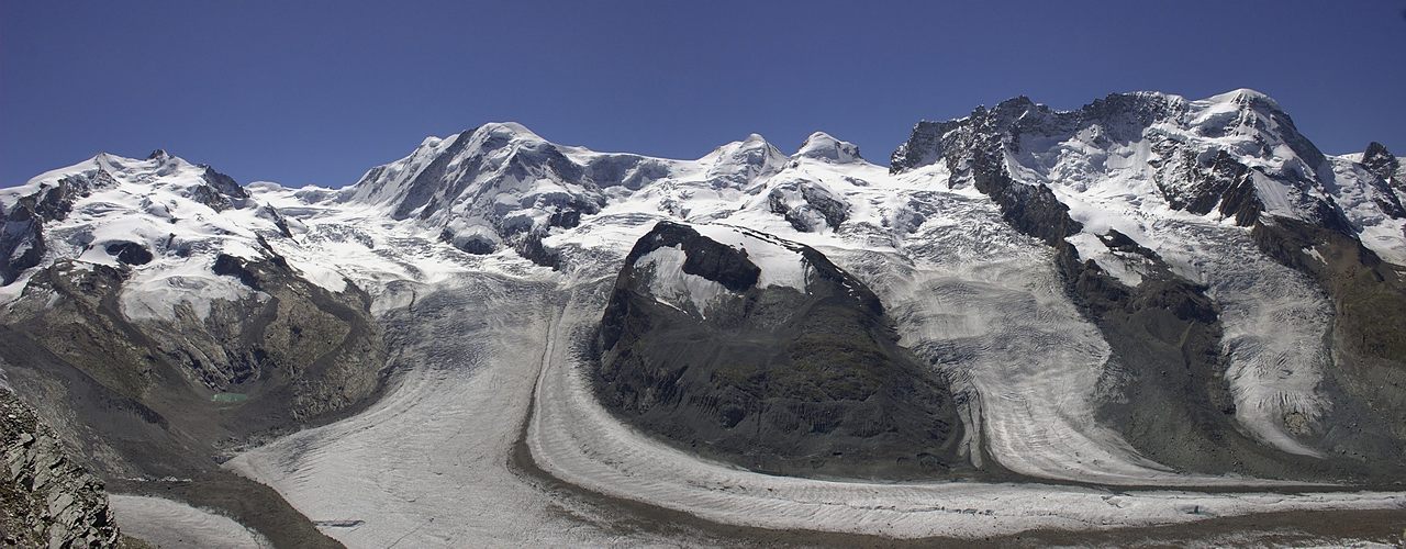
Panorama showing village and 7 of the 4000m peaks - click image for huge version
Live webcams
|
|
|
|
New - Live Mittleallalin panorama
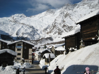
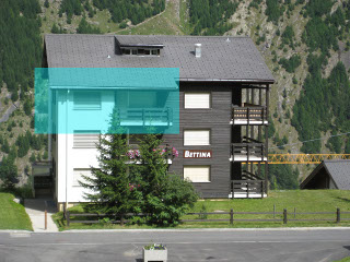
Our
apartment in Bettina
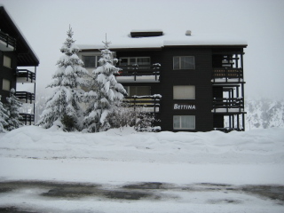
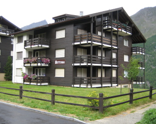
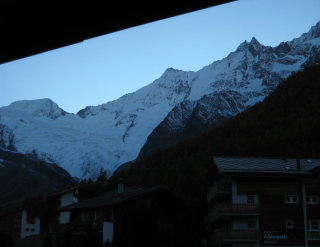
Built in approximately 1983 Bettina is typical of the chalet-style apartments of Fee with extensive use of wood in a building that has just 11 apartments on 3 main floors. Bettina is situated on the northern edge of Fee in the district known as 'Wildi' with a superb view of the mountains from the balcony or lounge of our apartment as shown below (Oct 2008).
 .
.
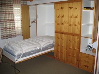
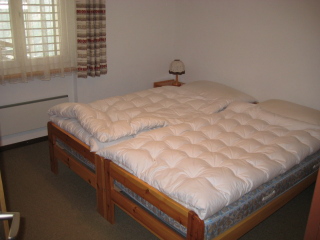
The apartment consists of an open-plan living-dining room with kitchen area and a balcony outside the dining-area. Within the lounge area 2 extremely comfortable single beds can be hinged down from the wall - this area can be closed off by a ceiling-hung concertina wooden partition for privacy. A hallway leads to a twin-bedded room, bathroom with shower over bath with screen and the apartment door. Total area is ~50 square metres.
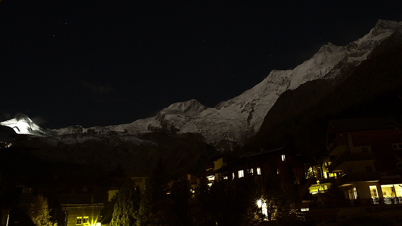
Moonlit view from balcony (Oct 2017) Floodlit Alallin on left
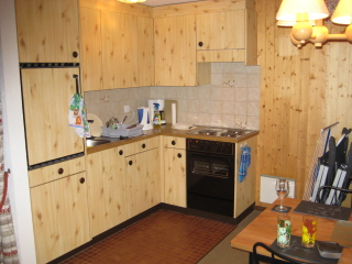
Kitchen
Fridge
with freezer compartment, 3-ring electric hob and electric oven,
filter coffee maker, kettle, stainless sink, cooker hood, microwave,
small breadmaker. Extensive range of cupboards, crockery, pans,
utensils, glasses. Range of condiments, spices, herbs, tea,
coffee. 'Emergency pack' of pasta, sauces, rosti, beer, wine etc. for
late arrivals.
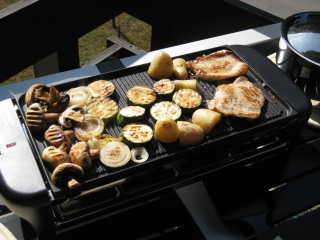
Thermostatic electric griddle/raclette
maker for use on balcony - think of it as an electric barbecue
|
|
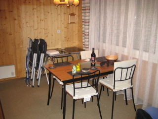
Dining
area
Table & 4 chairs, also balcony table and 2 folding fabric chairs and 2 folding dining chairs. Large window and door to balcony (sunrise & sunset views below).
|
|
|
|
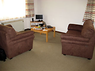
Lounge area
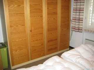
Two new (2009) sofas, coffee table, computer(2010) & monitor, speakers and amplifier for mp3 player etc. Also wardrobes, cupboards, board games. Two pull-down wall beds that have the same type of mattresses as the main beds. Duvets, pillows and bedding. Main electrical storage heater in this area with thermostatic fan boost and override. Folding wooden partition wall for night-time privacy. Three windows including panoramic mountain view.
|
|
Bedroom
Twin single beds, tables, wardrobes (1 private) and window. Wall mounted heater. Duvets, pillows and bedding.
|
|
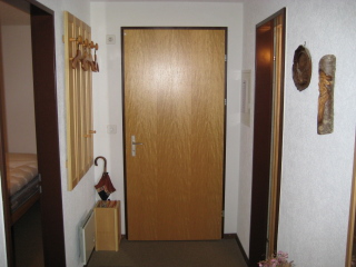
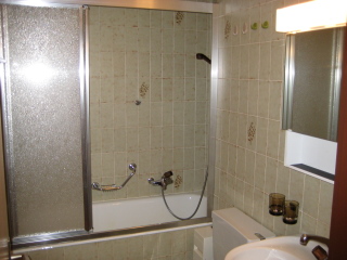
Hallway & Bathroom
Short hallway with cupboard, hanging space, boot space and mirror. Bathroom, fully tiled, with sink, toilet, bath with shower over, cupboard, shaver point, heater
|
|
Activities
Skiing
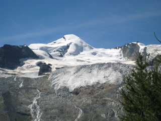
Due
to the extensive glacier at ~3500 m skiing is possible throughout the
year although there are certain periods when the cable-car system is
restricted or closed. Many national ski teams spend extended periods
training here outside the competition season, including the summer
months. The altitude of the resort means guaranteed snow in the
winter season (mid December-mid April) with nursery slopes at the
southern edge of the village. Further skiing areas are to be found
above the neighbouring villages of Saas-Grund & Saas-Almagell.
Free ski-buses circulate around Fee taking skiers to the lift
systems. One of the main stops is immediately outside Bettina. Cable
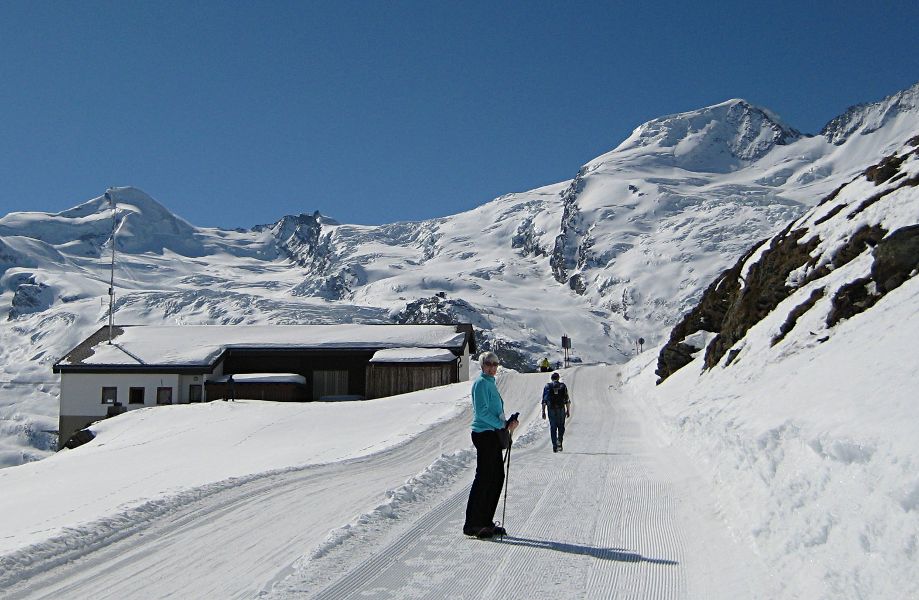
cars run from the village to Plattjen (~2580m), MittelAllalin
(~3460m) , Langfluh (~2830m), Hannig (~2400m) with intermediate stops
and many lifts & tows.
Walking/Mountain biking
Many
kilometers of marked trails include easy, moderate, strenuous
walks of lengths varying from a few kilometers to long distance
and international trails. Height gain/loss can be epic with the most
extreme example being the Mischabelhut path which rises ~1500m in
an horizontal distance of ~3000m from the centre of the
village. Several relatively easy glacier crossings are possible
particularly from the top Felskinn cable-car station to the
Britanniahut, although local advice should always be obtained about
current conditions. More extensive mountain and ice climbing is
supported by the Fee mountain guide office.
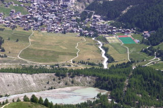
Sports/Activities
around the village (apart from the obvious !)
Outdoor sports centre with all-weather football pitch
Outdoor/Indoor tennis courts
Indoor swimming pool
Golf driving range
Short-hole golf course
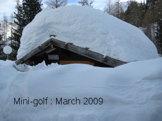
Mini-golf -probably summer only ! - see photo
Woodland adventure park
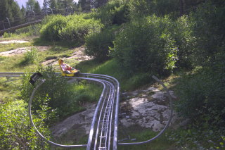
Rodelbobbahn - toboggan on rails - towed to highest point on track - brakes to slow descent
Downhill giant scooters (trottibikes) from top station of Hannig cable car - toboggans in winter
Many other activites on links from :
|
|
Travel
Car
Saas-Fee
is ~580 miles from Calais by the shortest reasonable route
(Calais-Reims-Dijon-Besancon-Pontalier-Lausanne-Sion-Visp). Most of
this route is motorway except 50 miles from Besancon to Val Orbe
(near Lausanne) and 30 miles from Sierre to Saas-Fee although
the Rhone valley motorway is steadily progressing from Sierre to
Visp. We typically leave Cheshire at ~2.00am and stop mid-afternoon
near Besancon and complete the journey next morning reaching Fee
before lunchtime. Please
be aware that use of Swiss motorways requires a 'vignette' valid for
the current year costing CHF 40 which can be obtained at most border
crossings.
The
mountain road from Visp to Saas-Fee rises by ~1200m in ~24 km but is
generally of good standard and is used by regular bus services,
coaches etc. . The road has numerous avalanche shelters where the
width or visibility can be restricted. On passing through Saas-Grund
the road to Fee bears sharp right at the point where the valley road
to Saas-Almagell joins and climbs in several long sweeps up to the
entrance to the village.
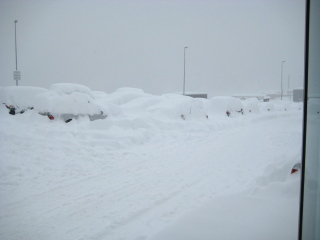
Although
this road has many avalanche shelters and is used by regular postbus
services it must be made clear that it is the only practicable way in
and out of the area and as such can be closed by heavy snow fall and
avalanche risk. Although great efforts are made to minimize any
delays, in exceptional winters the road can be closed for several
days with subsequent disruption to travel plans.
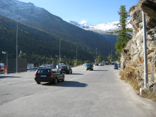
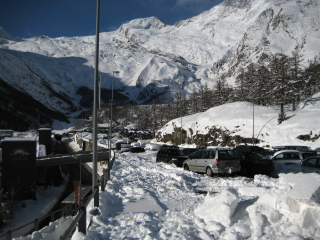
As
Fee is car-free,vehicles need to be parked in the extensive surface
and multi-storey municipal car-park at the entrance to the village.
This varies in cost depending on length of stay and time of
year but is approx. 10 CHF per day for stays of a week or so
with a discount obtained by having a SaasPass - Bettina has 2 spare
that are changeable each year to named individuals . The system
is intelligent so multiple exits/entrances can be made without losing
the time discount using the original ticket. The best parking
area when staying at Bettina is the north end of the surface car park
reached by entering the multi-storey, climbing 2 levels and turning
out right into the open air, across a bridge and then right to
the end of the car-park. Bettina is approx. 600m from here. The
picture (left) below is taken from approx. the northern end looking
south. This was mid-October - it's usually much
busier. For contrast the same car park is shown in the other 2
photos mid-March !
Bettina is numbered 152D on square U4
on the town map and is approx. 1km from the postbus
station
Saas-Fee
Map
From
the postbus the Tourist Office is across the roundabout.
They can hire you a luggage trolley - a taxi is ~25 CHF. To
reach Betttina go left from the office up onto the main open-air
car-park and along it's length to its northern end, turn left
after ~50m and carry on for ~200m, turn right and Bettina is on this
road after ~300m
SaasPass/BurgerPass/Citizen's
Pass
These are cards which provide a range of advantages such free cable-car travel, free postbus travel within the Saas villages ( Saas-Fee, Grund, Almagell and Balan and includes the Mattmark dam). Discounts are given on a range of other services and activities esp. parking. Bettina has 2 spare that are changeable each year to named individuals.and 4 transferable cards which give lesser discounts.
|
|
|
Air
Fee
is approx. 140 miles from Geneva airport with motorway for the first
~110 miles.
EasyJet cost £48 return ( March 2009 -
booked well in advance ) leaving Liverpool at 0700 and arriving
Geneva by 1000 (local time). By train Saas-Fee can be reached by
14:30
Air/Rail/Postbus
From
the arrivals lounge at Geneva the in-building station is ~100m. Here
2 trains / hour leave directly for Visp/Brig. The journey takes a
rather slow 21/2
hours but links with the twice-hourly Saas-Fee postbus which leaves
from outside Visp station to Saas-Fee. Tickets can be booked
manually or by machine at Geneva directly to Saas-Fee. Cost (March
2009) was ~75 CHF per person single.
|
The
time-table can be seen at :
Swiss
Train & Postbus
Return
postbus journeys from Saas-Fee to Visp need to be reserved several
hours or preferably the day before to be sure of a seat esp.
late in the day. This can be done before purchasing a ticket and is
just a guide to the operators to ensure no-one is left stranded
having, for example, walked into Fee.
Shopping
Fee
has a number of bread-shops, 4 supermarkets, 2 butchers and a
specialist cheese shop as well as a range of sport, gift &
jewellery shops.
Bread
Although
Bettina is on the edge of the village a bread shop is ~800m away
although a small supermarket ~500m away has a range of breads.
Outside the main seasons any particular breadshop may close on
certain days or entirely but there will always be a certain number
open.
The shops sell basic breakfast items such as jam,
butter, juice, milk & coffee as well as a range of breads. Some
of them are cafes serving breakfast early in the day and/or
sandwiches and cold-drinks for early walkers.
Supermarkets
Most
are in the village centre but a small supermarket is closer -
The 2 largest (Migros - no alcohol - & Coop)
are located a little below the main square.
Please
note that the larger supermarkets, like many continental
supermarkets, expect you to weigh items such as fruit and
veg. into the provided bags and then price them by selecting the
appropriate button on the scales and attaching the barcoded label the
scales produce
Arriving by car it can be
convenient to shop at Coop Saas-Grund which has parking outside the
shop.
Walking/mountaineering/skiing
A
considerable number of sports shops including hire of skiing,
snowboarding, ice-climbing equipment &
mountain-bikes
Gifts/Jewellers.
Several
Note : Rosti - Swiss "fast food". If you've never eaten this Swiss method of serving potatoes then you'll probably need to, as various sorts are served at almost every restaurant. Essentially grated potatoes pan-fried or oven baked but with lots of variety from a complete meal to a simple addition. In this area it's often pronounced like 'reschti'
Mountain -style cafe/restaurants
Cafe Alpenblick
Set
in pine forest at ~2050m, overlooking the village and with a
stupendous view this little alpine restaurant is open during the
daytime period for drinks, snacks and hot food. Depending on the
route the cafe (closed Sat. in the summer season) can be
reached in ~45 mins. from several points in the village and is
extensively signposted from various paths around Hannig. Most
of the seating is outside so preferably choose a good day to either
walk-up or ride the Hannig cable-car and walk down to it.
It's a favourite spot of ours especially when arriving in Fee before
lunch. Food is Valasian & Swiss alpine. We usually have a mixed
salad each and a simple main course such as rosti with Bratwurst
or vegetarian rosti but soups, sandwiches, Valasian cold plates with
cheese & dried meats are available as well as a good range of
beers, wines and non-alcoholic drinks
2 salads, 2 mains
courses, 2 beers and 2 glasses of open wine cost ~75CHF
Alp Hitta
This
(very) rustic restaurant is only ~50m from Bettina at the
extreme northern edge of Fee. Menu similar to Alpenblick but open in
the evenings. Some outdoor tables but most inside.
Cafe Gletchergrotte
Changed recently to a more up-market menu. This cafe, with a large terrace, is located on the the southern moraine rim of the glacier, just off the path up to Speilboden.
Restaurant Alpina at
Furggstalden
A little further afield. The small hamlet of Furggstalden is on an alp above Saas Almagell. Walk across the new bridge over the Fee gorge, branch left and follow the wide track down to Saas Almagell (~3km), cross the main road and follow the path to the Almagellertal - part way up the steep climb a path branches right to Furggstalden (~1920m). After a time you can cross a tarmac road with the path climbing past the old houses, barns and chapel of Furggstalden. Restaurant Alpina is on the left just beyond the main cluster. A sunny, south-facing terrace with views up to the Mattmark dam and the Italian border. Similar, though more extensive menus. Return by the same route or take the path near Almagell that leads to the north end of the village. Here is a fine waterfall, cross over the river and head for Saas Grund and eventually climb back to Fee by the chapel way which starts just after a campsite on the west bank of the river on the outskirts of Grund. An alternative may be to take the chairlift from the edge of Saas Almagell straight up to Furggstalden - where you'll see both Alpina and Restaurant Furggstalden ... so, a choice of refreshment!
All the cable-cars have restaurants/cafes at their top station - our particular favourite being Hannig having a large south-facing terrace with superb views of the mountains from Mittagshorn round to the Mischabel ridge. Menu is varied and quality good.
Fee restaurants (there are lots! - check out the gastronomy part of the SF web-site )
"Don
Ciccio”https://www.don-ciccio.ch/
Excellent Italian restaurant on the main street - owners are great people.
Essstube Essstube web-site
Very friendly restaurant on the way to Hannig cable-car. Variety of food - all good
Hotel Tenne Tenne web-site
Near Essstube but on the main street. Traditional Valaisian food. Friendly
Del Ponte
An Italian restaurant on the ground floor of the old Walliserhof hotel - now called Ferienart Resort & Spa. Wide range of Italian food and what is claimed to be the largest salad buffet in Switzerland - it's certainly enormous. Vast wine list which is rather pricy and mostly Italian. Salad starter, main course, cheapish wine and drinks to start will cost ~130CHF for 2 but can easily be higher.
Village tour - "ring road" (NB not possible to do the whole circuit in winter without crossing the piste!)
Leave
Bettina and head along the main road to Fee then turn to walk the
length of the car-park to the postbus station.
From the postbus
station head downhill, fork left after the sports centre and
cross the new bridge with its grand view of the village and
mountains, fork left on the track to Almagell and after a short
distance follow the path on the right that runs along a small bisse
(artificial waterway). This runs along above the east side of
Fee in pine forest passing through the adventure park and the Fee
Blitz toboggan run. Continuing under the Plattjen cable-car it
runs across open slopes and eventually reaches the old Felskinn cable
car. Pass under the wires close to the station and a path leads
down to a bridge over the river and then along the moraine.
A number of possible paths can be found - your aim is to reach the
highest path that runs along the meadows/nursery slopes to the
south-west of the village - this joins a track that leads upwards
to the small hamlet of Hohenegg. A path leads off on the right
approx. under the wires of the Hannig cable-car and heads in the
direction of Bettina, level at first but becoming steeper as you head
down towards the edge of Fee, eventually you can turn right off this
path after a house called Fee Katz and in a short distance will be on
a paved road. Turn left and follow the road and Bettina will be
seen after a short distance.
Hannig Panorama from Hannig
Lowest
of the cable-car stations, the ascent to Hannig is a relatively easy
walk (~5-6 km) through larch woods and alpside from
Fee rising about 550 metres. Several routes are possible. From
Bettina pass the 'Alp Hitta' and follow the road until several tracks
diverge & follow the 'Carl Zuckmayer' path which heads north
through forest with fine views to the right to Weissmiess &
Lagginhorn. At a junction of paths turn sharp left and ascend on a
path which eventually joins a track at an area called Melchboden.
This track can be followed to Hannig but there are several paths that
provide short cuts. Once above the trees the zig-zag track to
Hannig can be followed which sweeps out to the north. At Hannig there
is a large sun terrace with mag. views and a good mountain restaurant
& toilets at the cable-car station.
A
further ascent from Hannig can be made to the ridges above called
Mellig, the first part over a wide well-marked path then giving
way to a narrower path with some exposure at times until the highest
point is reached at ~2750m. Fine views of everywhere esp. the
Mischabel ridge. A path descends from here to join the Grachen
long-distance path, otherwise retrace your steps.
There
are several routes of descent. Carry on past the cable-car and
the main route down departs to the left over bare mountainside in
zig-zags until after passing a goat-farm and some abandoned buildings
it drops below the tree line above Cafe Alpenblick. From here
several obvious paths lead to Fee.
Otherwise, from the
cable-car keep on the main path which descends to cross a stream with
glacier and snow above and joins the main path down from the
Mischabel hut.
Fee -
Saas Grund - Saas Almagell - Fee
A short day walk taking
in the "Chapel Way" from Saas-Fee to the valley bottom
south of Saas Grund, along the river to Saas Almagell, and return up
the wide track Saas-Fee.
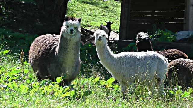
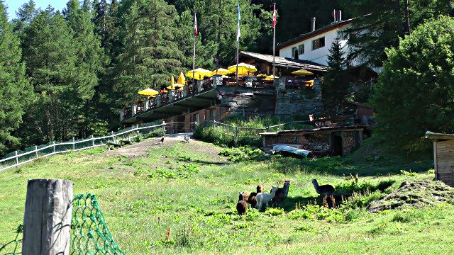
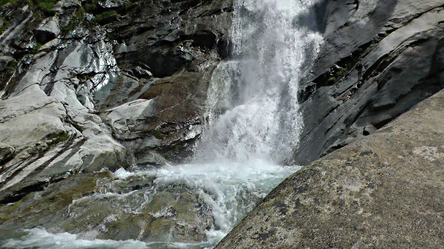
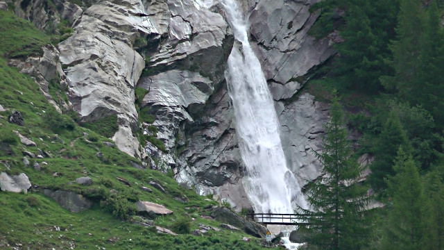
From the Saas-Fee post office follow the signs to the Chapel Way. This starts behind the youth hostel near the Post Office. The path descends steeply passing the many small chapels that line the path. (At the larger chapel/church a path can be taken down to the Fee gorge and then up to Waldhaus Bodmen on the Almagell-Fee track. Here is a cafe/restaurant and some unusual animals (photos below : top left/right), including a camel and alpacas) Otherwise head down the Chapel Way until it reaches the river at the valley bottom - a short walk to the left will take you to Saas Grund otherwise turn right and head past a campsite and into the small hamlet of Unter-den- Bodmen (cafe), carry on along the river and Saas-Almagell will be seen on the other bank with a large waterfall dropping from the hanging valley of Almagellertal at the northern end of the village. Several paths on the east bank of the river lead to the base of this where there is a large 'plunge-pool'.(photos below : bottom left/right) and upwards to the Almagellertal itself. Saas Almagell is a small village with one or two cafes. If you have stayed on the west bank of the river you will have passed the wide track that leads back to SF through pine woods, passing the Waldhaus Bodmen, over the new bridge and back to the post office.
|
|
|
|
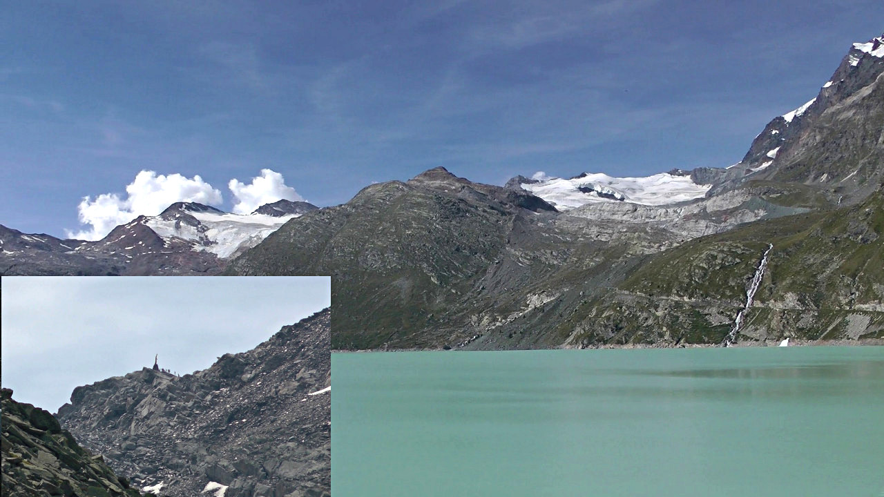
Mattmark
Drive
or post-bus to the Mattmark dam (2200m) which is at the top end of
the valley about 5km beyond Saas Almagell. There is
considerable parking here and a cafe/visitor centre. There is a good,
mostly level path, ~7km, all round the lake including some tunnels on
the west side.
At
the far end the path branches off to the ancient foot pass of Monte
Moro (~2850m) which makes a fine walk of its own although quite
strenuous. Only go on a fine day although then it will
often be busy. Expect some small amount of
scrambling and some snow on the higher part. From the top on
the Swiss /Italian border there is a stunning view of Monte
Rosa massif with the east wall glaciers running down to the Macugnaga
valley ~1650m below
The views from the east side of
the lake provide a great view of the large glacial plateau and passes
that separate Saas-Fee from Zermatt. This is the area where
ice-climbing began. From the dam crest in good visibility the
view to the north shows the Saas valley and further away the
symmetrical peak of the Bietschhorn with its graceful ridges on
the north side of the Rhone valley
Mattmark (inset the
Monte Moro pass with the monument "Madonna of the Snows")
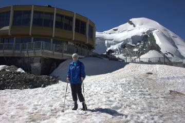
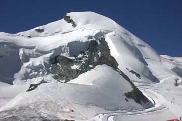
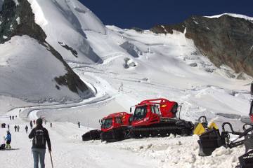
Mittleallalin
- "Alpin Express & Metro Alpin"
This
heavily-used system runs from close to the new Fee bridge in two
stages using large continuous cars to "Morania" at ~2600m
and then Felskinn at ~3000m. From here a short walk underground leads
to the bottom of the Metro Alpin which is an underground funicular
that travels to MittelAllalin at ~3500m. The summer ski area is
accessible from here as well as staggering views in all direction.
The non-climbing-non skier can exercise on a reasonable path that
leads to the "Guides monument". After traveling in
the world's highest underground railway the world's highest rotating
restaurant awaits.
At certain times of the year the Alpin
Express is replaced by the old Felskinn cable-car whose valley
station is beyond the meadows/nursery slope to the south of the
village. - photos from August 2012
|
|
|
New - Panorama north from Mittleallalin The mountains to the north of the Rhone valley many of them 30-40 miles away
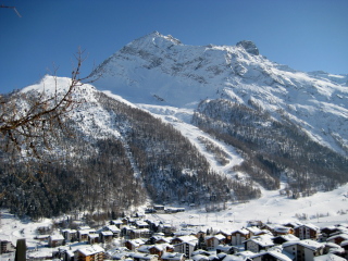
Hannig
Lowest
of the cable-car stations at ~2340m Hannig - photo from March
2011.
Starting point for a walk that takes in a fair amount of exercise, a 650m ascent and a glacier crossing and finally a trip back by the Alpin Express. Also gives access to a downhill walk to Berghaus Plattjen, an old stone hotel and restaurant at ~2400m
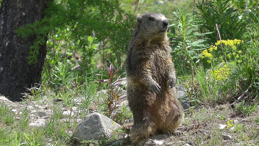
Spielboden & Langfluh
Spielboden
is located on the moraines between the two arms of the glacier at
~2460m and is very popular for marmot spotting. The marmots here are
quite tame but it is essential to only feed them the correct food -
root veg., wholemeal bread etc. The cafe at Spielboden sells bags of
this. A further cable-car from here goes to the mountain hotel
at Langfluh (~2870m), starting point for ascents of Alphubel and
crossing of the glacier to Felskinn or Mittelallalin (2-3km).
Note
- a colony of marmots has now established itself much lower,
just below the Felskinn cable-car station, on the west bank of the
stream, adjacent to the short-hole golf-course at the edge of
the village. The marmots are shy but can be quite tame
with humans (esp. with food) but very wary of dogs. Very
stale wholemeal/granary bread is accepted gratefully ! - Photo from
May 2012
Kreuzboden & Hohsaas
From the cable-car station in Saas Grund, Kreuzboden (~2400m) is reached in 1 cable-car stage. Fabulous views of the mountains around Fee and starting point for some walks. A further stages ascends to Hohsaas (3100m) where the views are even better. Photos from August 2012
New - Panorama from Hohsaas showing the mountains from Monte Rosa to Allalin [*]
[* ] At the extreme left Monte Rosa, the highest mountain in Switzerland, located on the Swiss -Italian border, is about 15 miles away in this picture. You might spot the Margherita hut which was built in 1893 right on the top of the Signalkuppe peak at 4,554m , and is the highest mountain hut, and indeed building, in Europe ( Queen Margherita of Savoie opened it in person ! ) At the extreme right is the Allalin (best viewed fullsize )
Furggstalden
If
you don't want to walk there is a small chair lift from the southern
end of Saas Almagell to the hamlet of Furggstalden where food and
view may be your aim or the start of some seriously hard walks
including several long hauls into Italy. Fine views to Monte
Moro.
Zermatt (~40km by road)
Famous
car-free neighbour in the adjoining valley - shortest route is
to walk over the Mischabel ridge!! Otherwise take a postbus or
coach or drive to Tasch, park in the the large terminal car park and
ride up to Zermatt on the train. Zermatt is usually VERY
busy although often much quieter off the main street. Many
people arrive on tours, walk the main street, take a snap of the
Matterhorn and then depart. They miss a LOT. Zermatt is
about 3-4 times larger than Fee with a number of outlying
hamlets. LOTS of walking/climbing. Too much to describe
here but one or two musts are :
Gornergrat -
situated on a ridge at ~3100m, overlooking an amazing view of peaks
along the Swiss-Italian border with the glaciers all merging below
Gornergrat. Can be reached in an all-day walk or rather
more easily by train from just outside Zermatt station.
Klein
Matterhorn - The highest cable-car in Europe with a final
unsupported span of ~3km takes you to the side of the 'little
Matterhorn' from where a tunnel leads to the ice of the
Theodolerplateau and a lift travels to the top of the peak
itself. Very high (3900m) and with 360 degree views.
Schwarzsee
- on the way to the Matterhorn - take the cable-car from Furi and
walk down through Stafelalp and Zmutt
Hamlets
- Wonderful little places like Zmutt, Findeln, Zum See - all with
restaurants and cafes
Live-cams
|
|
|
|
Big
Matt ( summer 2011)
Glaciers below Gornergrat. Mountains from left to right Monte Rosa, Liskamm, Caster & Pollux. Breithorn ridge and Kleine Matterhorn. (Summer 2005, our wedding anniversary and a very long day -1500 m ascent)
Bettmeralp (~40km
by road)
A small car-free village set in a wonderful spot on the north side of the Rhone only accessible by walking or cable-car. Can be reached from Brig by road or by train which stops at the large cable-car station where there is also extensive car-parking available. The main reason for visiting to Bettmeralp is to climb or ride to the ridge above which has a stunning view in all directions of what seems to be most of Switzerland, but especially the regions around Fee, Zermatt and, to the north, the huge valley of the Aletsch glacier - the longest in Europe outside the Arctic, which runs from Jungfrau-Eiger-Monch ridge for ~20km to emerge near Brig
Other
mountain areas - in
progress
Grimentz
Zinal
Belalp
Grachen
Rhone
glacier
Arolla
Leukerbad
Brig
Lotschental


![Panorama from Hohsaas showing the mountains from Monte Rosa to Allalin [*]](PanMR_All.jpg)